— Sloth Boss
Authentication Required
Permission Required
The NØTWORK
Powered by
Main
Home
Help
Explore
Explore
Mastery
Compete
Leaderboard
Rewards
Toggle Sidebar
Back
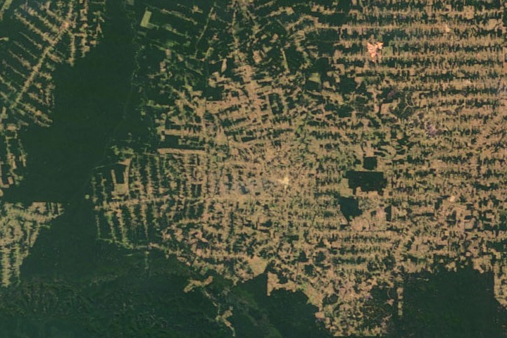
Environmental Science
Amazon Deforestation Satellite Tour
Interactive
Base
Description
Mark as Complete
Like
Bookmark
Share
earthobservatory.nasa.gov
World of Change: Amazon Deforestation - NASA Science
The state of Rondonia in western Brazil is one of the most deforested parts of the Amazon. This series shows deforestation on the frontier in the northwestern part of the state between 2000 and 2012.
View Content